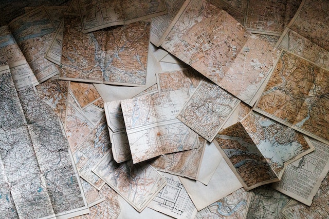
Labeling a Map: Your Key To Exploring the World Like a Pro
Generally, maps convey information about different geographic locations in the world. However, accurate labeling is crucial to creating a clear and informative map. Labeling a map enables you to represent the details on a map, such as locations, roads, and landmarks, in an organized manner. This can be important for business purposes, especially for logistics and delivery services.
Labeling a map may seem daunting if you are unfamiliar with the strategies for creating effective labels. It is beyond making different representations on maps. Making labels on a map entails different factors that can make your map clear and easy to read.
In this article, we’ll consider making labels on a map and show you different techniques for creating a detailed map.
What Are Labels on a Map and Features You Must Note Before Labeling a Map?
People often ask, “What are labels on a map?” They are text on a map that helps to identify features. They also help establish a visual hierarchy and focus the user’s attention on the map’s purpose. Map texts help to describe features, like rivers and oceans, and distances (latitudes and longitudes) between places.
Before you start labeling a map, there are certain features you must know. Some of them include the following:
- Area Features
The area features, such as vegetation (green), water (blue), and densely built-up areas, are usually the first features people see on a topographic map (grey or red). Lines (straight, dashed, dotted) represent characteristics, and map texts explain their meaning.
- Line Features
Line features represent linear features such as rivers, trails, and streets. These features only have one dimension and can only measure length. Line features have a starting and ending point. Line types (solid lines, dashed lines), color, and line thickness combinations distinguish linear features from one another. For instance, when labeling a map, you can use a thick solid black line to represent a main road. A thin dash blue line may also represent suburbs and shortcuts.
- Point Features
Points represent nonadjacent features and discrete data points. Since points have no dimensions, you can’t use them to calculate length or area. Schools, mountain peaks, and culvert locations are some examples of point features. They also represent abstract features like city names or place names.
- Polygon Features
Polygon features represent areas such as a city’s (on a large-scale map) boundary or a lake. Polygon features are two-dimensional; thus, they can calculate the area and perimeter of a geographic feature. You can distinguish polygon features by thematic mapping symbology (color schemes), patterns, or a color gradation scheme.
3 Steps on How to Label a Map on Google Maps
Google Maps is one of the most popular mapping tools people use today. It shows a satellite view based on Google Earth data. It allows you to add public places to a map, such as businesses and landmarks, and assign private labels to locations. Labeling a map on Google Maps is very easy. Here are the three steps on how to label a map on Google Maps on your Android and iOS devices
Step 1: Open the Google Maps app on your smartphone.
Step 2: Search for an address or drop a pin by tapping and holding a place on the map.
Step 3: At the bottom, below the address or location’s name, tap “Label.” It is the third icon from the left.
After labeling a map, if you want to find a location you once labeled, follow these steps:
- Open the Google Maps app on your mobile phone
- Tap on “Saved” and tap on “Labeled.”
- Click a label you want to see on the map
Labeling a Map on an Excel Sheet
Excel Map chart feature is one of the best tools for business data analysis. This feature is best for companies with a vast database that depend on geospatial analysis. Labeling a map on an Excel sheet is a simple process. The steps are as follows:
Step 1: Put your data in a table and include the location properties to be on the map.
Step 2: Drag and select your data cells, and click on the “Insert” tab. Navigate to the charts category on the “Insert” tab and click the dropdown. You’ll see “Maps.” Select “Filled Map.”
You will see the “Data” tab on newer versions of Excel. Click it and find “Geography.” A small map icon will pop up. It can take a few seconds for different data types to load. Click “Filled Map,” and your map should appear on the screen.
Step 3: After adding your map, you can make adjustments by adding a color scheme, headings, legends, and labels. Select the chart to add data labels to your map and click “Chart Elements” on the right. Select “OK” after checking the “Data Labels” box. The options for labeling a map enable you to customize different regions.
It is important to note that not all data types can work on Excel Maps. Labeling with data like continents, street addresses, and latitude/longitude is only possible via a map routing tool with Excel location data integration.
Importance of Labeling a Map for Businesses
Map labels play an essential role in businesses and non-governmental organizations (NGOs). Usually, they label maps to visualize their global presence. Labeled maps are essential because businesses use them for analyses that can help them make sound economic business decisions. Here are some important analyses businesses use maps for
- Proximity Analysis
Labeling a map helps businesses in conducting proximity analysis. Proximity analysis entails analyzing the locations of features by calculating the distance between them and other features in a particular area. Many commercial organizations use it to find suitable sites for business outlets. The technique considers various factors, such as social and economic demographics and the presence of competitor outlets. With the help of map labels, proximity analysis answers questions such as:
– How far is the distance between points?
– What is the route and cost to reach different points? - Finding Clusters
Labeling a map can help businesses group related points on a theme using multiple algorithms. A cluster can include specific densities of an event or population, such as racial profiles in a given area. Cluster maps help businesses group valuable information into different clusters, making it easy for companies to differentiate between valuable and redundant data. - Area Analysis
Map labels allow businesses to perform area analysis. For instance, businesses can analyze natural components in an area and to know if industrial activities can excel in that location. It can also help them reach their target customers, hit revenue goals, and promote growth.
3 Classifications of a Labeled World Map
A labeled world map represents the continents, oceans, countries, meridians, and the geographic coordinate system. Interestingly, it has three classifications. Let’s quickly take a look at them.
- Topographic World Map
Topographic world maps show the shape of the earth’s surface, including mountains, craters, lakes, rivers, valleys, trails, and roads. Contour lines act as markers to indicate the surface’s shape. When contour lines are close together, it means a steeper slope.
When they are further apart, the elevation change is smaller. Shaded reliefs and colors show elevations on a topographic map. Geologists, surveyors, engineers, outdoor enthusiasts, hunters, and the military use topographical maps. - Physical World Map
A physical world map shows natural landforms and features like deserts, mountains, oceans, lakes, and rivers. It does not show contour lines or provide exact elevations. Instead, it depicts elevation change with a color gradient ranging from green to brown to grayscale scales. The darker colors begin at sea level and gradually lighten as elevation rise. A physical map helps businesses and government agencies to analyze political boundaries, such as major cities or roads. - Political Maps
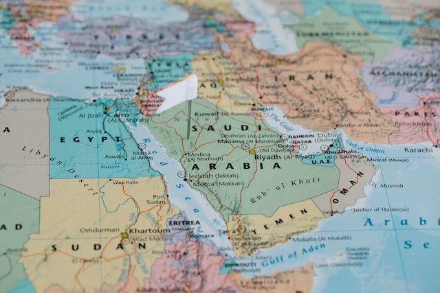
This may not necessarily be a world map. However, it can be a reference map or a thematic map. It depicts the borders of countries, states, and counties and shows capitals, cities, roads, railroad tracks, and major waterways. A classic example is the map of the United States showing the borders of the 50 states.
When labeling a map, businesses make reference to a labeled world map. Businesses use them to identify potential markets, plan logistics and transportation routes, and analyze the distribution of natural resources. Labeling a map also helps governments to plan infrastructure projects, allocate resources, and monitor geopolitical developments.
6 Rules To Follow When Labeling a Map
Map labels include text, shapes, colors, and lines, and their purpose is to help users understand the map. However, labels can make the map difficult to understand if you don’t place them correctly. When labeling a map, there are specific rules to abide by. Here are some rules to keep in mind:
- Stay moderate with the number of typefaces on a map. Use a typeface with numerous variations. For instance, the Google Maps team uses “Roboto” because it has multiple weights and variations that help create a typographical hierarchy.
- Consider what should stand out the most and what should stand out the least on your map. Create a hierarchy among your feature labels by varying font size, weight, style, and kerning.
- Place texts rightly when you want to label a map. In modern cultures, people read from right to left, so the text on a label should flow in that direction. The direction should be along a diagonal linear path (straight or curved). If the line runs vertically, label it top to bottom rather than bottom to top.
- Avoid “text crashes” when labeling a map. This means that your labels should not collide with each other or with dark-colored objects on the map.
- Stick to easy-to-read text colors when putting labels on a map. This improves readability.
- If you want to display your map digitally, remember to anti-alias it. Anti-aliasing is a technique for minimizing the distortion of features when representing a high-resolution image at a lower resolution.
Labeling a Map Is Easy if You Use the Right Mapping Tools
People assume that the sole purpose of labels and text on maps is to name geographic features. While this is true, they also serve a variety of other purposes. Labeling a map helps understand feature placements, identify relationships between them, and get valuable insights. However, labeling a map is labor-intensive and time-consuming.
Using the right mapping tools can make the process simpler and faster. With the right tools, you can automatically label your map and ensure that the text is readable and aesthetically pleasing. You can also add extra features like anti-aliasing to make your map look even better.
Interestingly, Mapize provides the tools, maps, and data to analyze and understand how geography affects you and your business. Depending on your preferences, this mapping software automatically decides which locations to label and place texts. Mapize displays practical label combinations and allows you to choose various map backgrounds (shadows, halos, shields, stretch labels). You can try us out for free and create your first map today.