Map Multiple Coordinates Using Mapize
Mapize makes mapping easy and simple. Now you can map thousands of coordinates in just a few short steps. All you really need to map multiple coordinates is your data saved as an Excel or CSV file and Mapize’s latitude and longitude finder tool.

Mapping Latitude and Longitude Coordinates
Mapize’s smart tools are designed for ease of use without compromising the quality of results. With Mapize, you can quickly and easily plot multiple geographic coordinates on a map – from tens, hundreds, or even thousands of latitudes and longitudes. All it takes to map multiple coordinates are three simple steps:
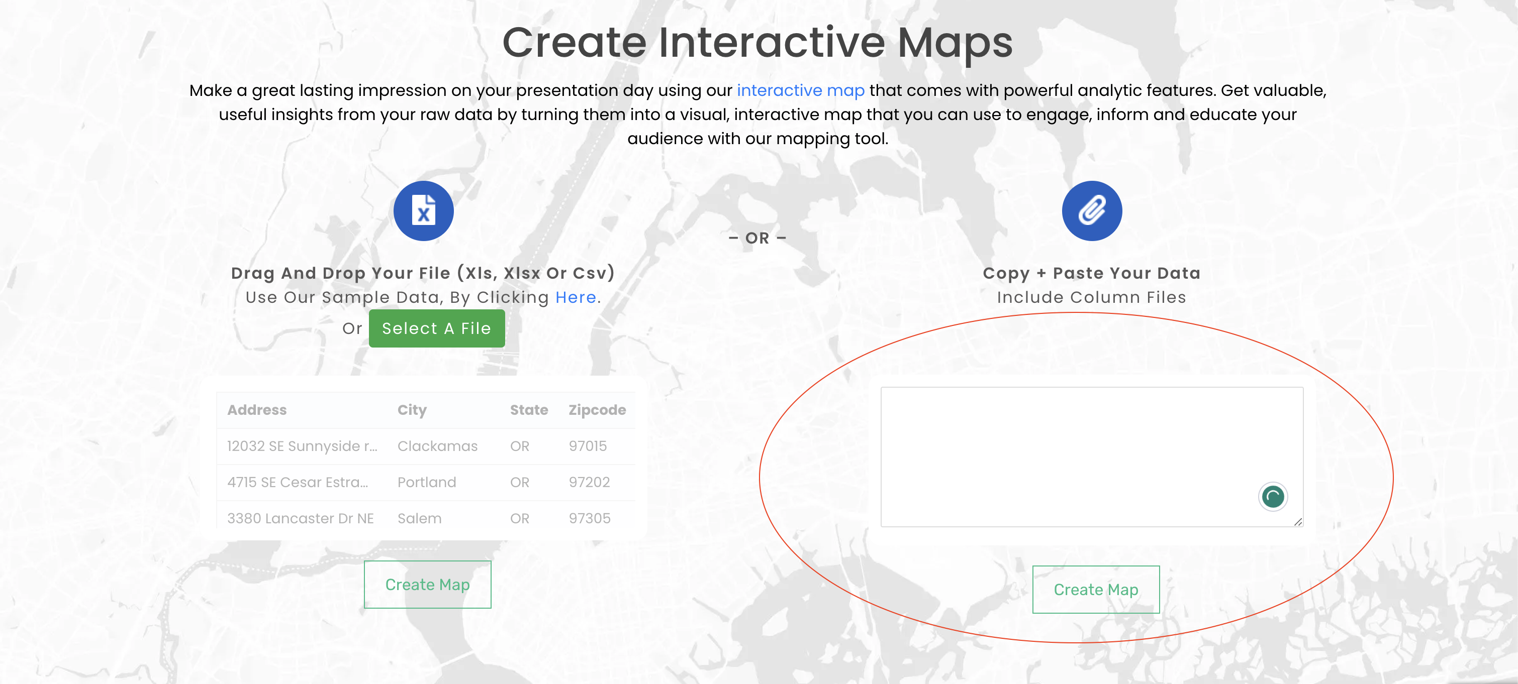
- Open the spreadsheet containing your map coordinates.
- Copy and paste the spreadsheet data into the Mapize homepage’s location data box.
- Generate your map by clicking on the “Map Now” button. (You also have the option to “Set and Validate” your data to ensure that all the information is correct and in the proper columns.)
And you’re done! Learn more about creating custom maps using multiple coordinates and How To Make A Map Online. Utilize these steps when mapping latitude and longitude coordinates. You can also follow along when you have GPS coordinates or a GPS location and want a coordinate finder tool to assist you.
How To Find Data to Plot Multiple Coordinates on Maps
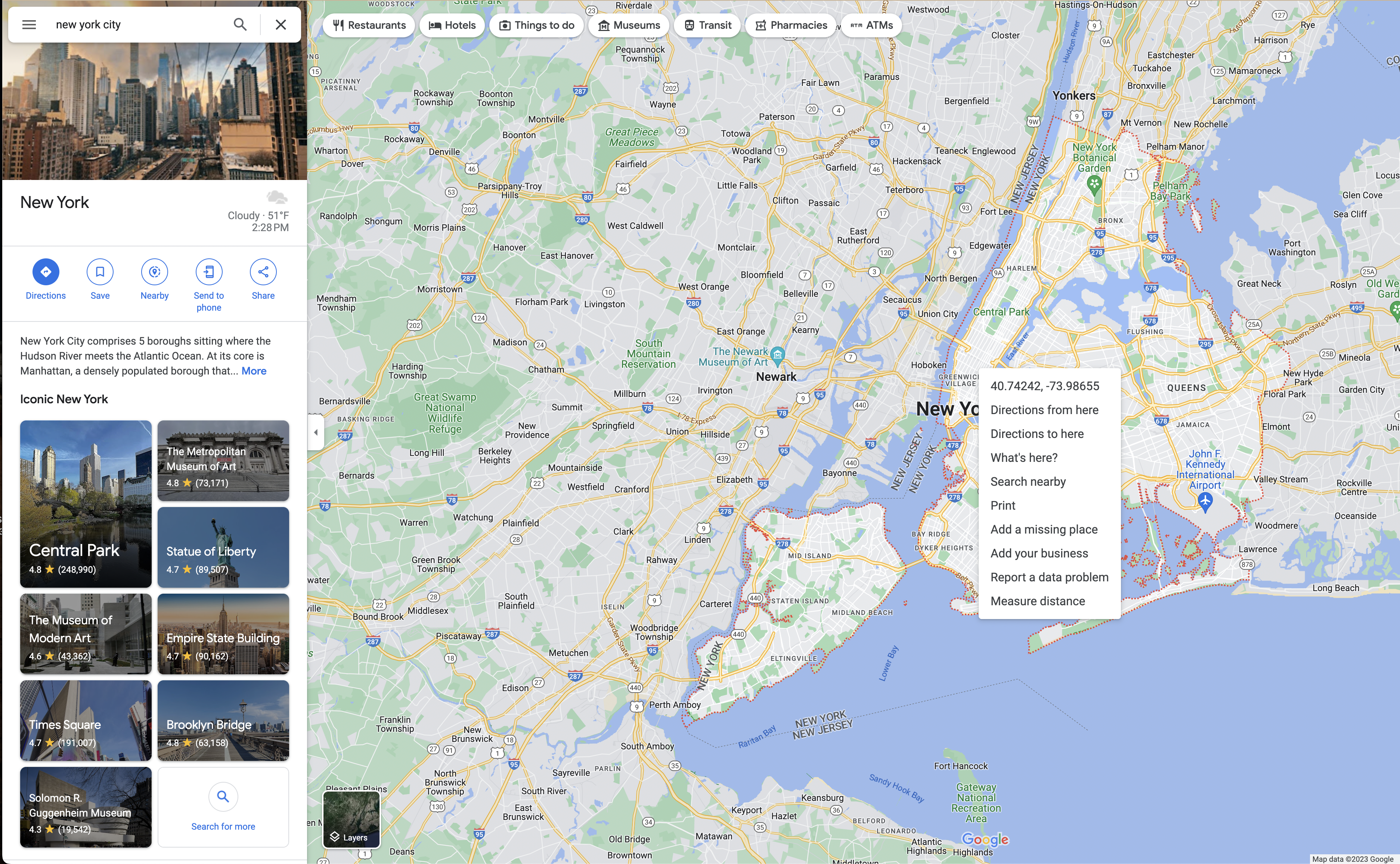
Learning how to plot latitude and longitude coordinates doesn’t have to be confusing. Pin point multiple locations using the Google Maps website. Right-click on any map point to reveal the spot’s latitude and longitude coordinates. Use this data to plot multiple coordinates on maps using Mapize.
Now you know how to pinpoint locations manually so you can map multiple coordinates. Other ways to obtain data for your spreadsheet include using another GPS coordinates locator or tracking down coordinate spreadsheets online.
Map Multiple Coordinates Using Different Format Types
There are various ways you can write coordinates. In order to map multiple coordinates using Mapize, we recommend using decimal degrees (DD) or degrees, minutes, and seconds (DMS). These are the most commonly used coordinate GPS points but let’s break down what this data looks like so you can input more than one location into a spreadsheet.
Map Multiple GPS Coordinates Using Decimal Degrees
Map coordinates in decimal degrees (DD) are the most common type. You can assign negative or positive values to your latitude and longitude pairs depending on which hemisphere they are found.
A sample decimal degree format looks like this: 48.858347, 2.294479
In order to map multiple GPS coordinates correctly with the Mapize mapping tool, pay attention to how you paste these values. The latitude and longitude values can be in separate columns or populated in a single column with the heading “Location.”
When using a single column, the latitude values should always be entered first and the longitude values second. Always separate the values with a comma, as denoted in our example above.
DMS and Examples of Other Common GPS Data Formats
When you can’t get your hands on latitude and longitude coordinates in degree format, Mapize can also work with others. When using formats other than the degree format, you can use either method by using either one column or two in your spreadsheet.
Again, the coordinate pairs may be negative or positive as determined by their hemisphere. Even when using a single column for all the coordinates, you should list the latitude coordinates first, followed by the longitude GPS coordinates. Always add a comma between these two data points to correctly map multiple coordinates with Mapize.
Our initial example pinpoints the Eiffel Tower in Paris, France.
Decimal Degrees (DD): 48.858347, 2.294479
Here are the Eiffel Tower’s coordinates written in other common GPS data formats:
Degrees Minutes Seconds (DMS): 48°51’30.1″N, 2°17’40.1″E
Degrees, Decimal Minutes (DDM): 48°51’N, 2°17’E
Degrees and Decimal Minutes (DMM): 48° 51.504′ N, 2° 17.67′ E
There’s a likelihood that your map coordinates will be among the listed ones above, but if not, follow the earlier guidelines to track down your coordinates on Google Maps.
Choose Mapize to Map Multiple Coordinates
When mapping multiple coordinates, Mapize will assist you. Besides working with map coords, our smart tool is also a mapping program for multiple addresses and specific locations. You can map multiple locations and find the fastest route on a multiple-location map.
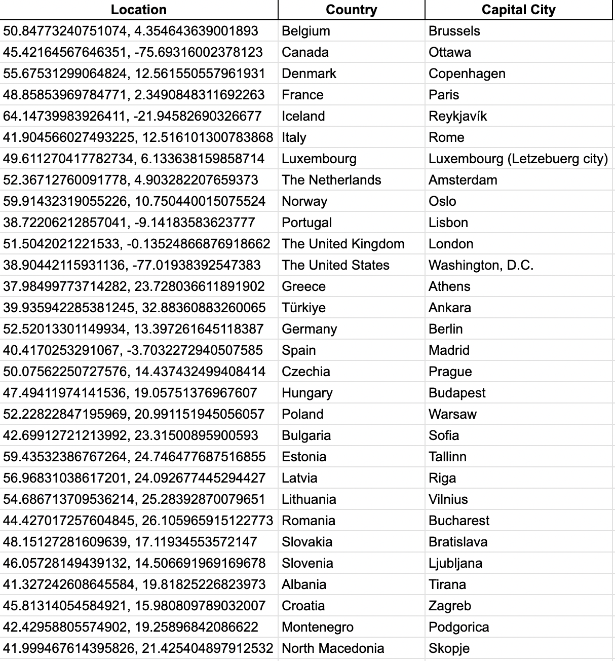
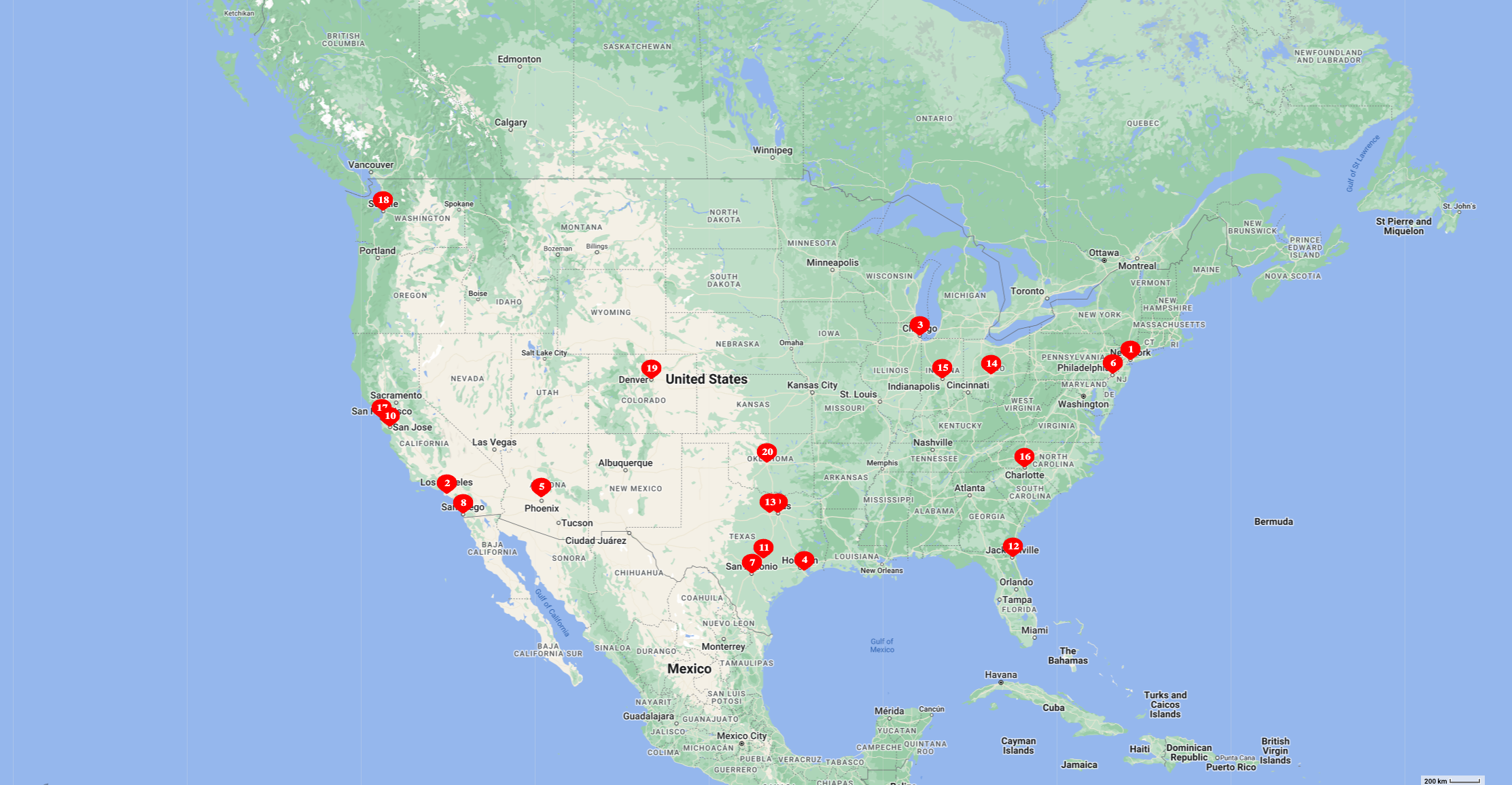
Here’s an example of an interactive map with multiple latitudes and longitude coordinates:
When you are making a map with multiple locations, Mapize will assist you. Plot coordinates on a map online with ease. Besides working with map coords, our smart tool is also a mapping program for multiple addresses. You can pinpoint multiple locations and find the fastest route on a multiple-location map.
Now you can create a map online using latitude and longitude data. Plot multiple locations on Google Maps to obtain your data set. All the locations can be GPS coordinates, or you can also map addresses and zip codes. Choose your marker icon, marker color and the look of your map. Obtain a map link, save it to share or embed it on your website. Create custom Google Maps using Mapize. Try us out for free and create your first map today!