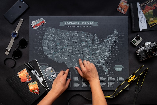
Map of the US With Cities: A Guide To Discovering America
Maps are powerful, valuable tools for exploring the geography of a region for educational, personal, and business purposes. A region’s map usually comprises states, cities, and towns, which helps people navigate these areas. When exploring a specific region, maps help identify key locations and understand its geography. One unique map under consideration is the map of the US with cities.
The United States is home to hundreds of cities with unique cultures, histories, and geography. When creating a map of the US with cities, attention to detail is crucial. This guide will provide an overview of creating US maps with cities, towns, and villages specific to your design needs and preference.
Map of the US With Cities: An Overview of the United States of America
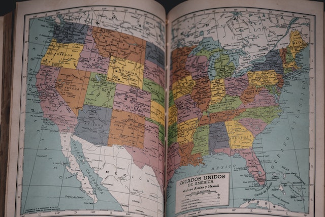
The map of The US with cities is a fascinating geographic region. The United States of America is a federal republic nation of 50 states with five major regions. The US is located in North America. It shares borders with Canada to the north, Mexico to the south, the Atlantic Ocean to the East, and the Pacific Ocean to the west.
By total land area, the United States is the world’s third-largest country, covering about 3.8 million square miles (some 9.8 million square kilometers). By comparison, it is twice the size of the European Union and more than half that of Russia.
The country has a population of over 330 million, making it the third most populous country in the world behind China and India. Its capital city is Washington DC., with its largest city – New York City.
One iconic feature of the United States’ geography is its map. You can quickly recognize the map of the US with cities thanks to its distinctive shape compared to a jigsaw puzzle piece.

5 Geographic Regions of the Map of the US With Cities
On the map of the US with cities, every 50 individual states are divided into five major geographic regions. Let’s take a look at these regions.
- Northeast
This region borders Canada in the north, and the Atlantic Ocean borders it in the west. They are also known as the New England States. The states in the Northeast region are New York, New Jersey, Pennsylvania, Delaware, and Maryland. - Southeast
This region lies in the country’s southeastern part and includes states such as Kentucky, Tennessee, North and South Carolinas, Alabama, Mississippi, Arkansas, and Louisiana. The states in this region are famous for their warm climate, hospitality, and diverse culture. - West
This region is in the western US and includes states such as Washington, Idaho, Montana, Wyoming, Utah, Alaska, and Colorado. They feature diverse landscapes from major mountain ranges such as the Cascades, Pacific coast ranges, and the Sierra Nevada to beaches along the Pacific Ocean. - Southwest
The countries in this region include Texas, Oklahoma, Nevada, Arizona, and New Mexico. This region is popular for its desert landscapes and rich Hispanic culture. - Midwest
The Midwest is the central part of the United States. It comprises of dozen states such as North Dakota, South Dakota, Ohio, Indiana, Illinois, Michigan, Missouri, Iowa, Nebraska, Wisconsin, Minnesota, and Kansas.
Each state of the US has its respective major, minor, and capital cities that map developers can consider implementing on their maps. Learning how these states arrange into regions helps to understand the map of the US with cities, big or small.
Understanding Map of the US With Big Cities
The map of the US with cities features hundreds of cities that have become part of the country’s urban landscape. However, when creating a map of the US with big cities, it is necessary to understand that certain cities are considered “big.” This is usually due to their size, population, and economic features.
A big city is typically a metropolitan area with at least one million people. These big cities include New York City, Los Angeles, Philadelphia, Miami, Houston, and Chicago. Each state in the US has several major cities that one cannot overlook when creating a map that features “big cities.”
One excellent way to create a map of the US with big cities is by using good mapping tools such as Google Maps, Microsoft Excel, or Arc GIS. These tools allow you to add pins or markers on these big cities to ascertain their locations. They also allow you to customize the maps by adding labels or color schemes to differentiate cities in their respective sizes.
As you utilize these mapping tools to create a US map with big cities, consider its purpose and the audience that will use it. For instance, this map is helpful for tourists who want to take their destination trips to big cities in the United States. They can enjoy major attractions or landmarks in each big city.
Furthermore, this type of map helps determine the geographical distribution of these cities. Notably, many big cities exist in clusters in certain regions, like the Northeast and the West. Others are spread out across the country. This geographic distribution provides valuable insights into the map of the US with cities. It also gives a better understanding of the United States’ economic and cultural landscape.
Understanding Map of the US With Cities and Towns
When creating a US map with cities, the big cities often get more attention than smaller cities and towns. It is important to note that many live in these areas, and creating maps for these settlements has geographic and social importance.
When creating a map of the US with cities and towns, you must consider the map scale and level of detail you want to include. As such, you want to ensure the audience knows every street, village, city, and town.
You can employ digital mapping tools to effectively create a map of the US with cities and towns. These tools can also help you add pins to indicate the location of each town or city. Ensure you attach map legend and scale at the end of your custom maps so that users can read the meaning of the map.
Overall, understanding how to create a map of the US with cities can be a valuable guide to anyone who wants to understand the country’s urban and suburban regions. By displaying the distribution of cities and towns across the US, you can appreciate various socio-economic and cultural features shaping the country.
How To Create the Map of the US With Cities
Creating a map of the US with cities is a challenging feat. However, with the right tools and expertise, you can make the perfect US maps for your personal and professional needs. While hundreds of mapping software and tools help you get started, you can use Microsoft Excel to create these maps. Let’s consider the steps to take in creating a US map with cities.
Step 1: Gather Your Data
The first step in creating a map of the US with cities is to gather your data. You require a list of cities (big or small) that you want to include on the map and their geographic coordinates (longitude and latitude).
Step 2: Launch Microsoft Excel
Once your data is set, open Microsoft Excel and select a new worksheet option. Input your city data into Excel with each city in its row and the geographic coordinates in separate columns.
Step 3: Insert a Map
After inputting your city data in Excel, click “Insert” and select the 3D map option. This will insert a map into your Excel workbook.
Step 4: Add Your City Data
Click the “Add Data” button in the toolbar to add your city data to the map. Select your city data from the Excel workbook. Your cities will now appear on the map with a pin or marker.
Step 5: Customize Your Map
To customize your map, click the “Map Options” button in the toolbar. You can adjust the color scheme, map type, size, color of your pins, and other visualization features to suit your preference.
Step 6: Save Your Map
When you finish the process, save your map on the Excel workbook using the “Save As” option. Choose a file name and location, and click “Save.”
Mapize Can Effectively Create Custom Us Maps for Your Personal and Business Needs
Indeed, the map of the US with cities helps navigate big and small cities in the country. Understanding these maps can provide valuable insights and help you make informed decisions whether you are a tourist or a business entity.
While using Microsoft Excel helps provide custom US maps with cities, you should ultimately consider Mapize. Mapize is an online mapping platform that allows you to create custom maps using your data or data from other sources, including Google Maps.
With Mapize, you can easily add markers, labels, and other visual elements to your map to help highlight key features. You can also access data visualization tools like heatmaps, choropleth, and cluster maps. These features can be valuable when analyzing data related to cities and towns, like population density. Endeavor to join Mapize today and create your first map.