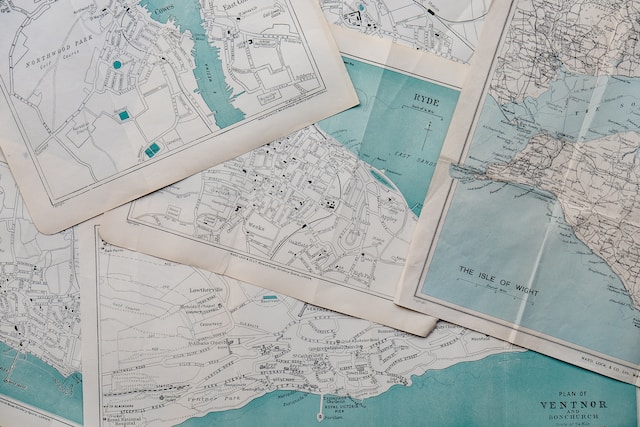
Maps are the foundation of our knowledge of the world. They guide us when exploring unfamiliar territories and expose hidden treasures on earth. They portray geographical features visually, allowing us to travel, explore, and make sense of our surroundings. Maps come in a variety of shapes and sizes. The topographic map is a map that stands out among different maps.
Compared to standard maps, which focus on political boundaries or road networks, topographic maps contain precise information about the physical features of a specific location. They depict three-dimensional elements of the earth’s surface, including elevation, topography, and natural and artificial features. In this article, we’ll learn more about topographical maps, their importance, and how to read them.
What Is a Topographic Map?
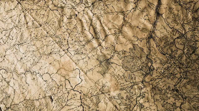
People often ask the question, “What is a topographic map?” It is a type of map that depicts the earth’s surface, including physical features, contours, and elevations. These maps express a specific location in detail, including geography, landforms, water bodies, and other natural or artificial elements.
Topographical maps visually depict the three-dimensional world on a two-dimensional plane using contour lines, symbols, and colors. These maps give an accurate and comprehensive picture of the Earth’s topography. As such, they assist individuals, corporations, and governments in making educated choices and navigating their surroundings by giving.
The United States Geological Survey (USGS) topographic map series is one of the most well-known and widely used series. The USGS topographical maps include extensive and precise topography information, such as contours, elevation, water bodies, and landmarks.
These maps cover diverse places in the United States and are available in various map scales to suit multiple mapping needs. These scales range from 1:24,000 to 1:250,00. They are one of the most popular options for topographical mapping in the United States because of their lengthy history, dependability, and extensive coverage. Now that you know what a topographical map is, let’s dive into what it reveals.
What Does a Topographic Map Show? 4 Elements on Topographical Maps
You might be wondering, “What does a topographic map show?” A topographic map reveals an area’s physical properties (elevation, topography, and natural and artificial elements). It depicts variations in elevation using contour lines, letting viewers visualize the shape of the land. Let’s discuss four elements on a topographical map in more detail.
1. Elevation and Contour Lines
Topographic maps show elevation mainly through contour lines. Contour lines connect points of equal height on the earth’s surface. These lines allow you to see hills, valleys, ridges, and other landforms. Users can acquire significant insights into the height and shape of a landscape by analyzing the arrangement and qualities of these lines.
2. Natural and Man-Made Features
Topographical maps show natural and artificial features on the earth through symbols and icons. Symbols, like points and lines, represent rivers, lakes, mountains, roads, houses, and vegetation. These symbols serve as a guide for reading and comprehending the features on the map. These features are critical for interpreting the surroundings, organizing activities, and navigating the globe.

3. Geographic Coordinates
Topographic maps represent geographic coordinates using a grid system of latitude and longitude lines. Latitude lines (parallels) run parallel to the equator defining a map’s north-south position. Longitude lines (meridians) converge at the poles to represent the east-west location.
Users can determine specific areas on the map by referring to the numerical values along these lines. Users must know how to plot latitude and longitude to identify particular points of interest, calculate distances, and travel correctly. This allows for more efficient communication and coordination of locations on the earth.
4. Relief and Shading
Topographic maps use shading and contour lines to show relief, or the difference in height and depth of the ground. Hill shading, for example, creates the illusion of three-dimensional relief on the map, giving a sense of the land’s shape and form. Shading improves the visual representation of mountains, valleys, and other landforms by imitating the influence of light and shadow.
Furthermore, contour lines are essential in portraying relief. Closer contour lines indicate steeper slopes, while more comprehensive lines indicate gentler terrain. The use of shade and contour lines gives people a thorough grasp of the land’s relief and aids in picturing its different elements.
5 Tips To Accurately Learn How To Read Topographic Maps
Mastering the ability to interpret topographical maps is crucial for outdoor enthusiasts, businesses, and government agencies. These maps contain much terrain information and can substantially improve navigation and exploration. Deciphering the detailed intricacies of these maps can be difficult. Here are some tips on how to read topographic maps accurately:
1. Familiarize Yourself With the Topographic Map Legend
A map legend (map key) guides you in understanding the map’s symbols, colors, and marks. It is usually at the corner of the map (a box or a list). Take time to read the legend and learn the meaning of each symbol or image. This will help you understand the map quickly.
Symbols and icons indicate numerous map aspects. Blue lines, for example, depict bodies of water. Black dots with concentric circles represent mountain peaks; other line patterns represent plant or land cover forms. There are many symbols and icons on a topographic map. To know the meaning of these symbols, consult the map legend.
2. Identifying Contour Lines Is Essential When Reading Topographic Maps
One of the most important components of a topographic map is the contour lines. They connect points of equal elevation and represent the land’s form. You should pay attention to their shape and spacing. Concentric circles of contour lines symbolize hilltops or mountains, whereas V-shaped contour lines represent valleys. The contour interval value is on the map’s legend. You can determine the steepness of slopes by comparing contour lines.
3. Interpreting Elevation in Topographic Maps
To determine the elevation of a specific place, find the contour lines closest to it above and below. You can calculate the elevation using the contour interval. If the contour interval is 20 meters and the location is between two contour lines, the elevation will be midway between the two values.
4. Analyze the Topographic Map’s Gradient and Slopes
Examine the gap between contour lines to determine the slope of a certain area. Closely spaced contour lines indicate steep slopes, while widely spread lines indicate gentler terrain. Contour lines that cross a stream or river indicate elevation changes along the waterway. By analyzing the spacing and orientation of contour lines, you can calculate the slope of a particular point.
5. Understanding Scales, Distance, and Coordinates in Topographic Maps
Topographic maps have a scale bar depicting the relationship and distance between the map and actual ground distances. You can use the scale bar to precisely calculate hiking or transit distances or measure distances between points and features.
Furthermore, Topographic maps include a grid of latitude and longitude lines. The intersection of these lines yields accurate geographic coordinates, which you can use to find and analyze locations on the map.
6 Benefits of Topographic Maps Across Different Sectors
Topographical maps have much importance to individuals, businesses, and government bodies. They provide essential information on elevation, topography, and natural features, which aids in safe navigation, environmental management, and scientific study. Here are six benefits of topographic maps across various sectors:
- Navigation and Outdoor Activities
Topographical maps are essential for people who like outdoor activities such as hiking, camping, and exploring. They provide extensive information about the topography, trails, water sources, and natural landmarks, allowing people to navigate safely and effectively plan their outdoor adventures.
- Infrastructure Planning and Development
Businesses and government agencies rely largely on topographical maps for infrastructure planning and development initiatives. These maps aid in the assessment of site suitability for building and the evaluation of elevation changes. It also helps identify potential impediments and determines ideal transportation and utility network routes.
- Environmental Management and Resource Conservation
Topographic maps are essential for environmental management and conservation. Researchers and government agencies use these maps to study and monitor ecosystems, estimate biodiversity hotspots, and manage natural resources sustainably.
- Disaster Avoidance and Emergency Response
Topographical maps are vital for catastrophe planning and response. These maps are useful for government agencies and emergency services during natural catastrophes or emergencies. For instance, they utilize them to assess flood-prone areas, plan evacuation routes, find safe places for relief centers, and coordinate search and rescue activities.
- Research and Exploration
Topographical maps are useful in scientific research and exploration in numerous disciplines, such as geology, geography, ecology, and archaeology. These maps contain vital information regarding landforms, geological characteristics, elevation changes, and remote locations.
- Cartography and Land Surveying
Topographical maps are essential for land surveying and cartography experts. Businesses use them to analyze location data trends, determine property boundaries, and conduct precise surveys for engineering and building.
Mapize: The Ultimate Online Mapping Tool
Mapize is an ultimate online mapping tool built on Google’s powerful API. This mapping tool includes topographic maps, which provide users with precise information about an area’s height and topographical characteristics. It has various tools for producing and customizing interactive maps, making it suitable for use by individuals, governments, and business organizations. Mapize provides high-quality map data, a wide range of customization options, and developer-friendly APIs and SDKs. Consequently, users can create highly customized maps that cater to their needs. In addition, you can collaborate with others, view your maps from anywhere, and discover new possibilities on Mapize. Create and explore your custom maps for free by joining Mapize today!