Latitude and longitude form the foundation of any mapping software. These days, you rarely see these measurements in the raw form. Instead, you see their visual representations, i.e., in the form of markers or other similar cues. For instance, when you open a mapping software like Google Maps, you can find the exact location via search. If you want to learn more about maps, you must know how to read latitude and longitude coordinates.
This guide shows you the process to interpret these geographic measurements. It also explains the different latitude and longitude formats and how to convert them.
What Is Latitude—Explained
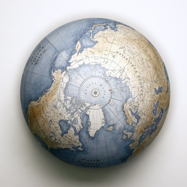
Latitudes are the imaginary horizontal lines you see on a globe or a map. They run parallel to the equator, which is another imaginary line. The equator is a horizontal line equal in distance from the north and the south pole. Generally, on any chart, you’ll find the following latitudes:
- Arctic Circle
- Tropic of Cancer
- Equator
- Tropic of Capricorn
- Antarctic Circle
Latitudes divide the planet into two halves—the Northern and Southern hemispheres. The equator is 0 degrees (°), which serves as the reference point. As you go north of the equator, the angle can reach a maximum of 90°, which is the north pole. Similarly, as you go south from the equator, it’s -90° at the south pole.
As you can see, a positive value for latitude means it is above the equator, i.e., the northern hemisphere. On the other hand, negative values are for latitudes below the equator, i.e., the southern hemisphere.
Although the Tropic of Cancer and the Tropic of Capricorn are on opposite sides, they have the same latitude measurements. It means they are the same distance from the equator. The only difference is that the Tropic of Capricorn has a negative unit.
Another way to indicate which hemisphere the coordinates belong to is to use the following letters:
- N represents the northern hemisphere
- S is for the southern hemisphere
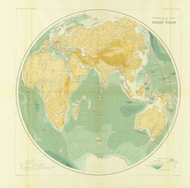
What Is Longitude—A Breakdown
Longitudes are also imaginary lines but are vertical by nature and connect the north and south poles. The longitude reference point is the Prime Meridian, which passes through Greenwich. It is a town located in the southeast section of London, England. As a result, cartographers also call it Greenwich Meridian.
Due to the planet’s shape, which is similar to an ellipsoid, you can say Earth is 360°. Each longitude represents a degree, which means there are 360 of them on a chart.
The Prime Meridian divides the longitudes into two, which means there are 180 of them on either side. If you go to the left of this reference point, it is the Western hemisphere. Similarly, the right of the Prime Meridian is the Eastern hemisphere.
There are several ways to represent longitudes:
- W is for the western hemisphere
- E indicates the eastern hemisphere
Another way to express longitudes is with positive and negative values. If it is positive, it is to the right of the Prime Meridan, which is the eastern hemisphere. Negative values are for the western hemisphere, which is to the left of the reference point.
What Are the Different Formats of Latitude and Longitude Coordinates?
You must know the different formats before explaining how to read geographic coordinates. There are three major types of latitude and longitude formats:
- Degrees, Minutes, and Seconds (DMS) – As highlighted earlier, you use degrees as the unit of measurement for latitude and longitude. In the DMS format, you divide the degrees into 60 minutes (‘), which you split into 60 seconds (“). For instance, the DMS latitude of New York City is 40° 43’ 50.1960” N.
- Degrees and Decimal Minutes (DMM) – A degree consists of 60 minutes, and you represent minutes as decimals in the DMM format. New York City’s latitude in DMM is 40° 43.8366’.
- Decimal Degrees (DD) – In this format, you use decimals to represent a latitude or longitude’s degrees. Using the previous example, the latitude coordinate for New York City is 40.73061°.
How To Read a Latitude and Longitude Coordinates
Now that you know the different formats, you can start learning how to read latitude and longitude coordinates. Usually, the geographical coordinates are in the DMS or DD format. For example, Google Maps shows you the latitude and longitude measurements in these formats. Anytime you come across these coordinates, they will always start with the latitude and then show the longitude. Below is a step-by-step breakdown of reading geographic coordinates:
- Identify the format of the latitude and longitude coordinates. If it is DMS, it will be in degrees, minutes, and seconds. Similarly, DD will only show degrees with multiple decimal places.
- Check for the letters N, S, E, and W if they are in DMS format. N and S indicate the latitude is top or bottom of the equator. Similarly, E and W inform you that it is either to the left or right from the Prime Meridian.
For DD, you need to see if the coordinates are in positive or negative units of measurement. A positive value for latitude indicates the location is above the equator. Negative numbers in latitude tell you it is below the equator. Similarly, positive and negative numbers in longitude are for east and west of the Prime Meridian.
Going back to the New York City example, the DMS coordinates are 40° 43’ 50.1960” N and 73° 56’ 6.8712” W. You will read this as:
- 40 degrees, 43 minutes, 50.1960 seconds north and 73 degrees, 56 minutes, and 6.8712 seconds south.
The DD coordinates for New York City are 40.730610 and -73.935242. You’ll read the following coordinates as:
- 40.730610 degrees north and 73.935242 degrees west.

How To Read Latitude and Longitude on a Sectional Chart
Pilots who fly planes and drones use sectional charts as visual navigation aids. They will show aviators critical information like controlled airspace, obstructions, airports, and restricted areas. It includes geographic data like railways, roads, residential areas, and other essential landmarks.
These charts will have latitude and longitude lines. You can also see the minutes in these latitude and longitude lines as small ticks. The fifth tick mark is slightly bigger, representing the midpoint, and the 10th is larger. They make it easy to count the minutes along the geographic coordinates.
When you look at this map with an untrained eye, it seems confusing and overwhelming. Fortunately, with some practice, it’s easy to interpret them. The guide below explains how to read latitude and longitude on a sectional chart:
- Identify the point of interest on the section chart.
- Draw a real or imaginary horizontal line from this point until it meets the longitude line.
- Trace a real or imaginary vertical line from the point of interest to the latitude line.
You now have the coordinates for the point of interest on the sectional chart. Use the tick marks where the lines meet to know the minute’s coordinates. The degree of the latitude and longitude will be along the lines.
Let’s say you want the coordinates of an airport on a sectional chart showing the 32° latitude and 94° longitude. By drawing the horizontal line, it meets at the 5th tick of the longitude.
Similarly, tracing the vertical line takes you to the 4th tick of the latitude. This reads as 32 degrees and 4 minutes north and 94 degrees and 5 minutes west.

5 Tips To Make It Easier To Read Geographic Coordinates From Sectional Charts
Understanding sectional charts and getting the geographic coordinates from various points of interest can still be challenging. All the lines and tick marks make the map look crowded. However, there are ways to improve readability if you remember the following pointers:
- You will see the latitude and longitude measurements for the lines in the corners where they intersect.
- Every sectional chart separates the latitude and longitudinal lines by 30 minutes.
- The tick marks in the longitude line will increase in value as you move towards the west. Similarly, they decrease as you go to the east.
- For latitude lines, the tick marks increase as you go north and decrease when you move south.
- Usually, alternative latitude and longitudinal lines have labels to indicate the unit of measurement.
How To Convert Latitude and Longitude Formats
When reading the latitude and longitude coordinates, you may get them in different formats. For instance, the sectional chart shows your readings in DMS format. But, you want it to be in DD format as it is easier to read or vice versa. The guide below shows you the formulas to convert the geographic coordinates as per your requirements:
DMS to DD
Every degree consists of 60 minutes, and every minute is 60 seconds. In other words, every degree has 3600 seconds (60 x 60). Use this formula to convert DMS to DD:
- Degree (d) – You don’t change this part of the coordinate.
- Minutes (m) – You divide the minute reading by 60.
- Seconds (s) – You use 3600 to divide the seconds.
DD = (d + m/60 + s/3600)
For example, 38° 53’ 23.2980” N and 77° 0’ 32.6016” W are the coordinates for Washington DC. Using the above formula, this is how to convert the latitude to DD:
Degrees – 38°
Minutes – 53/60 = 0.88333
Seconds – 23.2980/3600 = 0.00647
Washington DC’s DD latitude coordinate is 38+ 0.88333+0.00647 = 38.8898 degrees north.
Transform Your Geographic Coordinates Into Interactive Maps With Mapize
The above guides explain how to read longitude and latitude on a map in different formats. However, you don’t get a lot of information if you have tons of geographic coordinates. The best way to learn from these data points is to convert them into custom interactive maps with Mapize.
When you collect geographic data, it will be in different formats. Fortunately, this won’t be a problem with this online map builder, as it recognizes popular geographic datasets. All you need to do is include them in a spreadsheet to convert it into a custom interactive map. Make learning how to read latitude and longitude on a map easier by visualizing your data with Mapize. Try Mapize for free today to see how your geographic data looks on a map!