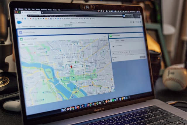
Geographic heat maps are excellent tools for visualizing data across different locations. They serve as a user-friendly and intuitive way to represent a complex data set. Consequently, they make it easy to identify patterns and trends that might otherwise be difficult to spot. From business and real estate to public health and elections, these maps have various applications across various sectors.
This article provides a comprehensive overview of heat maps and a detailed approach to creating them. After reading this article, you will have a solid understanding of creating, customizing, and interpreting geographic heat maps. You’ll also learn how to use them to achieve your desired goals in your business or personal endeavors.
- Understanding Geographic Heat Maps, Their Types, and How They Work
- How To Create Geographic Heat Maps Using Excel
- Creating Heat Maps Using Geographic Heat Map Generators
- Understanding Color Schemes and How They Affect Heat Map Creation
- Choosing the Right Locations for Your Geographic Heat Map
- Maximize the Power of Geographic Heat Maps Using Mapize
Understanding Geographic Heat Maps, Their Types, and How They Work
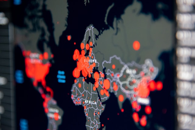
A heat map is a graphical representation of data that uses color-coded tiles or grids to indicate the intensity of data values in different areas. Geographic heat maps utilize color-coding techniques to illustrate the distribution of a variable or group of variables across a particular geographic area.
They help users easily recognize intricate patterns in sizable data sets that are challenging to spot using conventional charts and graphs. They are also beneficial in cases where data is dense, such as population densities or traffic patterns.
Geographic heat maps are important in many sectors and industries, including health, logistics, delivery businesses, etc. For instance, a business can use these maps to determine its customers’ distribution. This gives them insight into the areas with the highest demand for their products and services.
Health workers can also use these maps to monitor the spread of infectious diseases and identify areas with the most severe outbreaks. Ultimately, this can help them find and curb the spread.
Types of Geographic Heat Maps
You can use different geographic heat maps depending on the data you visualize.
- Point-based Heat Maps: You should use them to visualize point data, such as location data for retail stores.
- Density-based Heat Maps: They can visualize continuous data, such as temperature or humidity.
- Choropleth Heat Maps: This type of geographic heat map helps visualize data for a specific region, such as states or countries.

How Geographic Heat Maps Work
Geographic heat maps work by you aggregating data into regions and assigning color gradients to each part based on the intensity of data values. The colors you will use for the gradient can range from cool to warm. Cool colors may represent lower data values and warm colors higher data values.
The intensity of the colors indicates the strength of the data value in that region. You can customize these geographic heat maps to include additional data layers by labeling the map with markers or annotations to provide further context and clarity.
How To Create Geographic Heat Maps Using Excel
Excel’s geographic heat map feature offers an easy-to-use tool to create a robust data representation in minutes. Creating geographic heat maps using Excel is a simple and effective way to visualize location-based data.
Overview of Excel’s Geographic Heat Map Feature
To access this feature, you must install Excel 365 or the latest Excel version on your computer. Excel’s geographic heat map feature is a type of conditional formatting that uses a color scale to display data points on a map. The feature works by assigning each data point a color based on its value and then shading the corresponding area on the map with that color.

Step-by-Step Guide To Creating a Geographical Heat Map in Excel
If you want to create a geographical heat map in Excel, here are practical steps to guide you.
- Start by opening a new or existing Excel spreadsheet containing location-based data.
- Highlight the data you want to include in your geographic heat map.
- Click the “Conditional Formatting” button in the “Home” tab of the Excel ribbon.
- Select “Color Scales” from the drop-down menu.
- Choose the color scale you want for your map. Excel offers a variety of color scales to choose from, ranging from two-color gradients to multi-color scales.
- You will now see your data on a map, with each data point characterized by a color based on its value.
You can customize your map further by adjusting the legend, axis titles, and data labels. Furthermore, understanding Excel map functions can help you create your desired map. With the simple step-by-step guide and customization options, you can easily create a unique map tailored to your needs.
Creating Heat Maps Using Geographic Heat Map Generators
Creating a heat map can seem daunting, especially if you have no background in data analysis. However, thanks to geographic heat map generators, anyone can create a professional-looking heat map in just a few clicks.
Heat map generators are powerful tools for creating data visualizations for various purposes, including business analysis, data science, and market research. They allow you to transform data into meaningful insights and easily understand patterns and trends.
They use color-coded maps to represent data sets based on an exact collection of parameters. This makes it more straightforward to interpret and identify trends in the data.
Top Geographical Heat Map Generators To Consider
Here are some top options for creating your geographic heat map. Each tool has fantastic features and capacities to help you create a visually appealing and informative map for your data.
- Mapize: This is a popular geographic heat map generator that offers you a range of features and customization options. This includes multiple map styles, data importing, color schemes, markers, and analysis tools. With zero coding experience, you can generate an interactive custom map.
- eSpatial: This tool offers you advanced features and analysis tools, including data importing and exporting, territory mapping, and data filtering.
- Tableau: This is a powerful data visualization software with advanced customization options. However, it may require you to have some technical knowledge and training.
You can easily create and customize heat maps for various purposes using a good map generator.
Pros and Cons of Using Geographic Heat Map Generators
Geographic heat map creators are popular tools for generating visually compelling and informative maps. However, like any other tool, they have pros and cons. Here are a few pros and cons of using these map creators.
Pros
- User-friendly and easy to use, requiring no prior technical knowledge from you
- It saves you time and resources compared to manual data analysis
- Provides you with quick insights and analysis of data sets
- Offers you customization options for color schemes, data ranges, and map styles.
- It helps you generate interactive and engaging maps to share and embed in websites and presentations.
Cons
- Offers limited customization options compared to you using more advanced software.
- It may not provide detailed or complex data analysis.
- The quality of maps generated may vary depending on the tool used.

Understanding Color Schemes and How They Affect Heat Map Creation
Color schemes are essential when creating effective and visually appealing geographic heat maps. Color schemes help you convey information and data in an easily understandable way. With a suitable color scheme, your map can become straightforward to read for other viewers.
A color scheme selects and arranges colors used in a map to represent different values or data points. You must choose easily distinguishable colors and indicate the various data points presented. This will make it easy to interpret the data and make informed decisions.
Tips To Note When Choosing Color Schemes for Geographic Heat Maps
When selecting color schemes for your geographic heat map, there are several factors you should consider. Some popular color schemes include divergent, sequential, and qualitative. Also, it is essential to take note of the following tips:
- Divergent color schemes are ideal for showing data that has both positive and negative values
- Sequential color schemes are best for data with a clear range of values
- Qualitative color schemes are ideal for representing data that does not have a clear range of values

Choosing the Right Locations for Your Geographic Heat Map
Choosing the right location is also essential when creating your geographic heat map. The suitable locations will depend on the data you present and your intended audience.
For example, you create a geographic heat map to show population density in a specific area. In that case, it is essential to choose locations that accurately represent the population density in that area. It is also necessary to ensure that your selected locations are recognizable and familiar to the intended audience.
Choosing a suitable color scheme and geographic location allows you to create a heat map. It effectively communicates your data and insights to your audience. Ultimately, it will also help you make informed decisions that can help the growth of your business and the success of your study.
Maximize the Power of Geographic Heat Maps Using Mapize
So far, so good. We have discussed the concept of geographic heat maps and their importance in intuitively visualizing data. When creating them, it is important to remember the map’s intended audience and purpose. It would also be best if you prioritized clarity and simplicity over complexity. You should appropriately choose the color scheme and design carefully to enhance readability and comprehension.
Additionally, incorporating interactive features and using tools such as Mapize or Google Maps can improve the user experience and provide additional insights into the data. With careful planning and attention to detail, a geographic heat map can be a powerful data visualization and analysis tool.
Interestingly, Mapize is a powerful and user-friendly tool that enables you to create stunning customized maps easily. It is perfect for business and personal use. You can try us out and create your first custom maps for free today.

